Cours du grand fleuve Missisipi
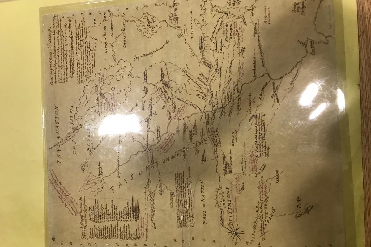
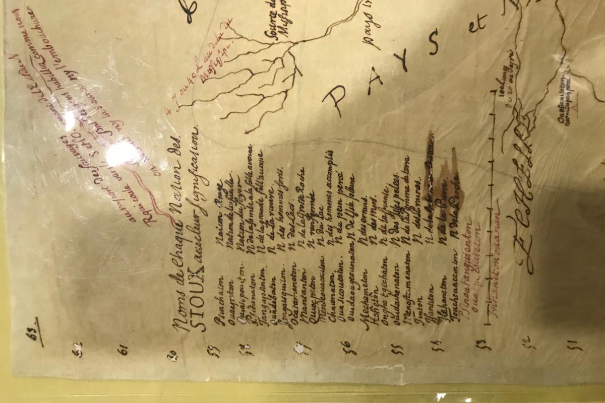
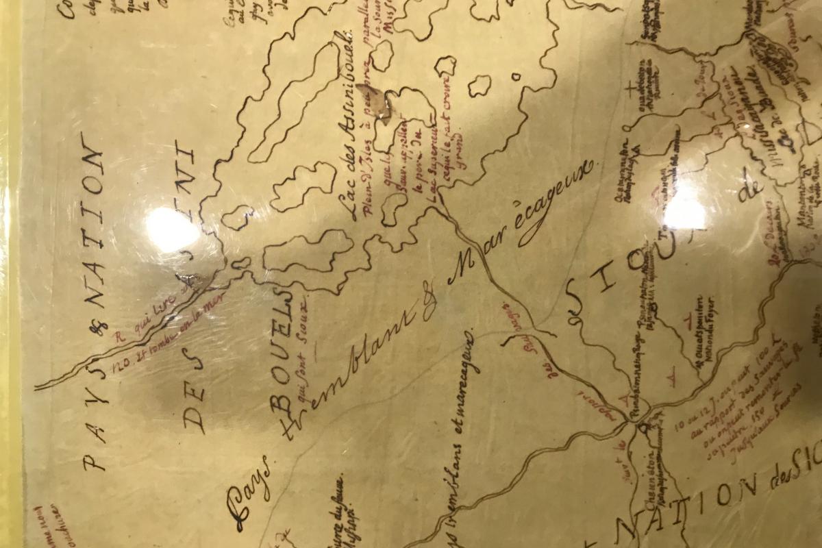
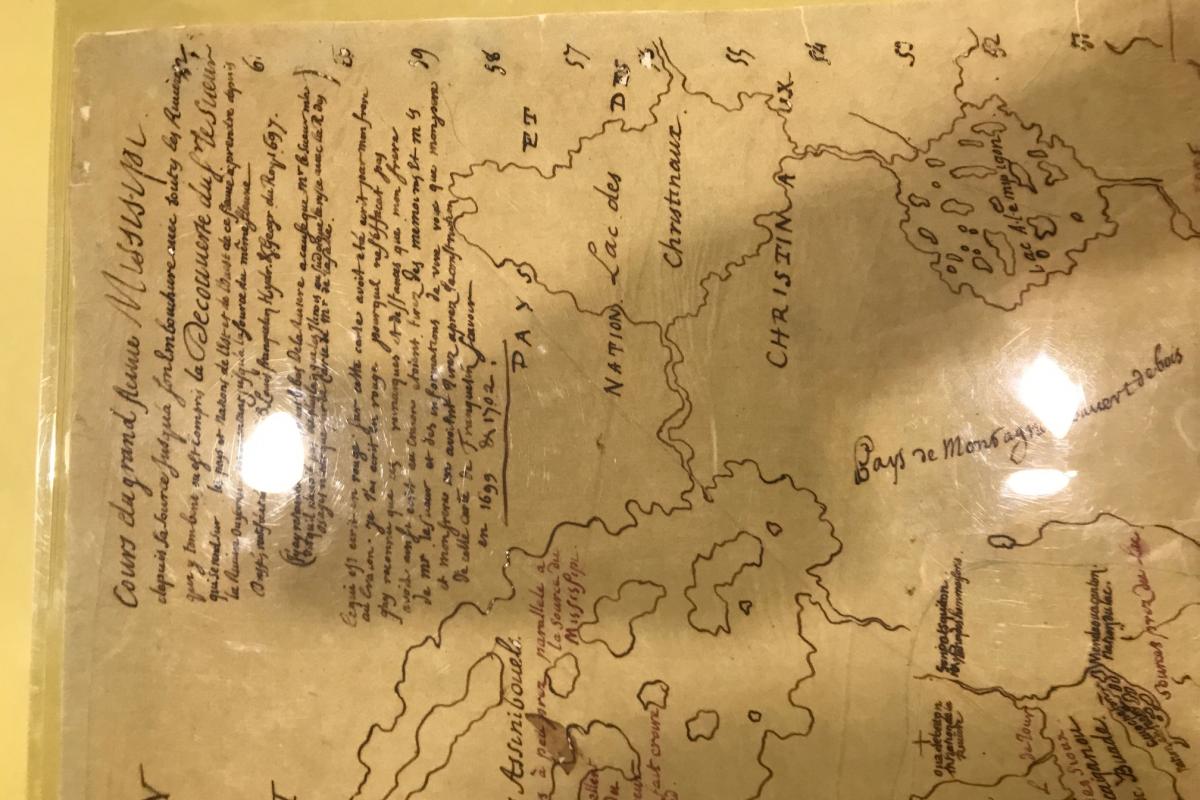
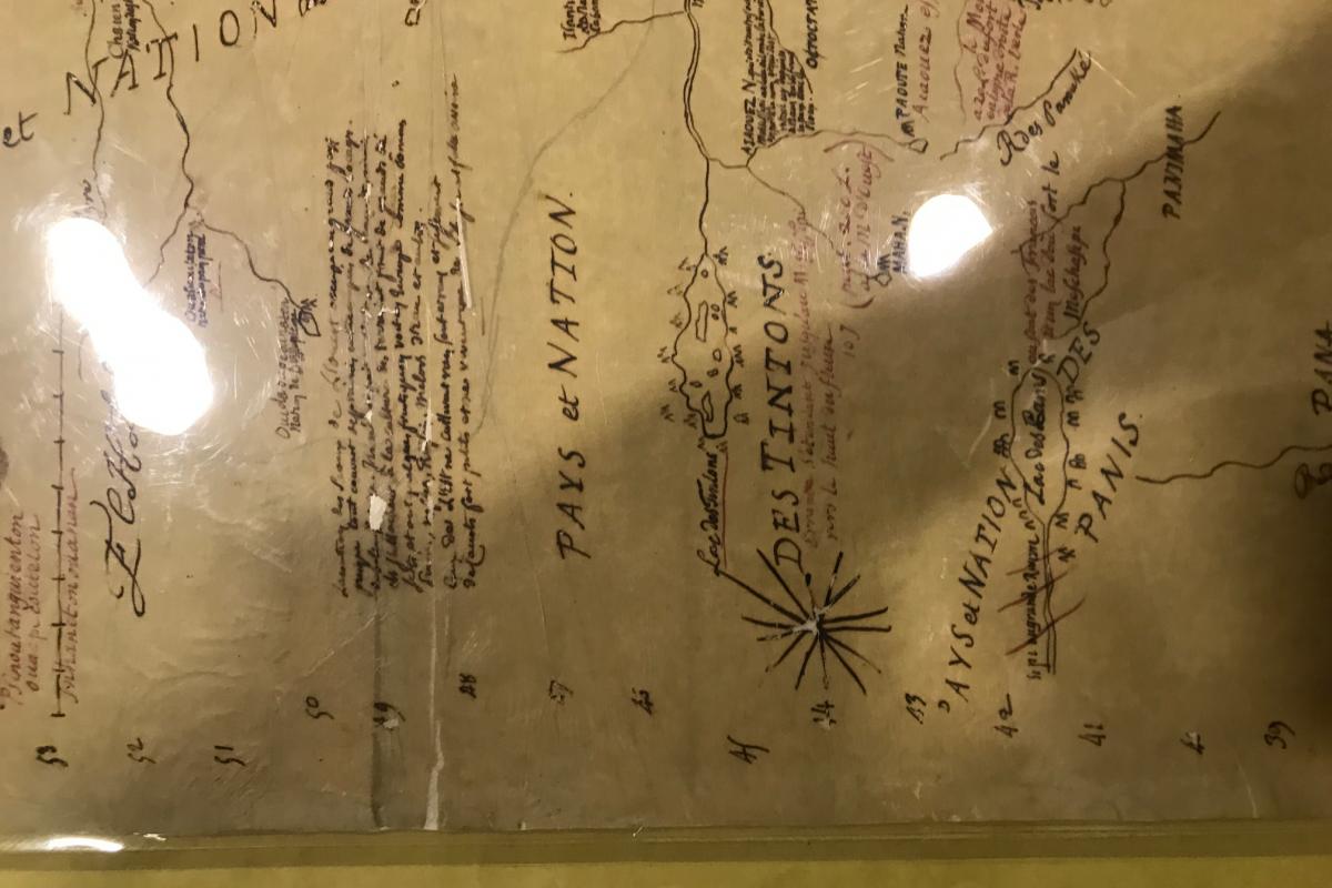
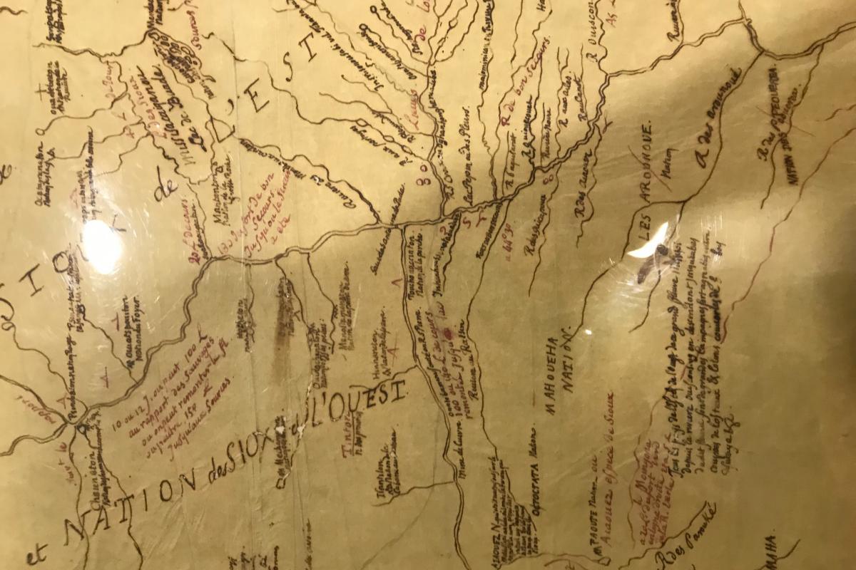
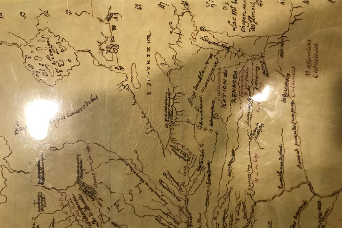
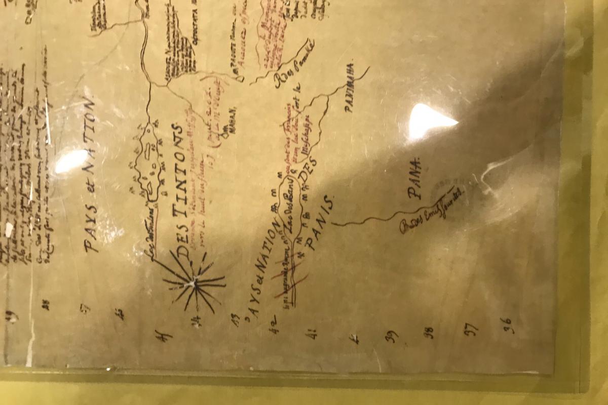
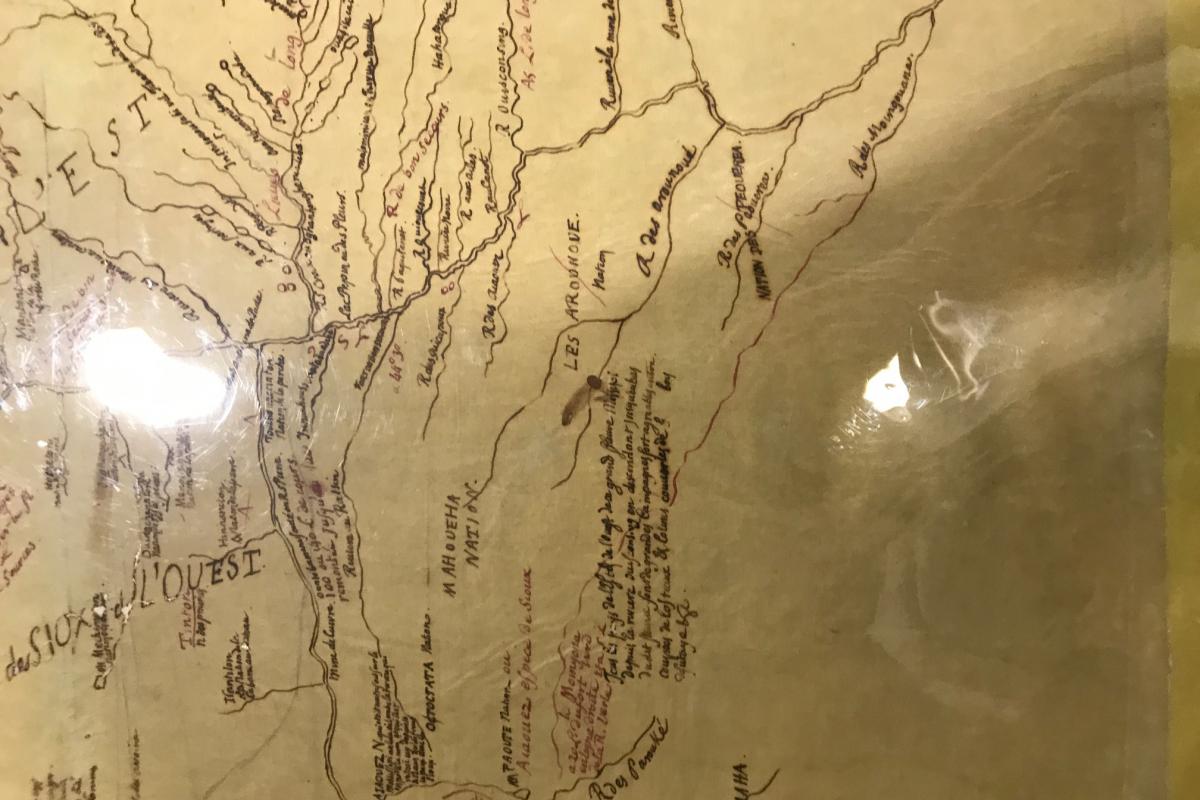
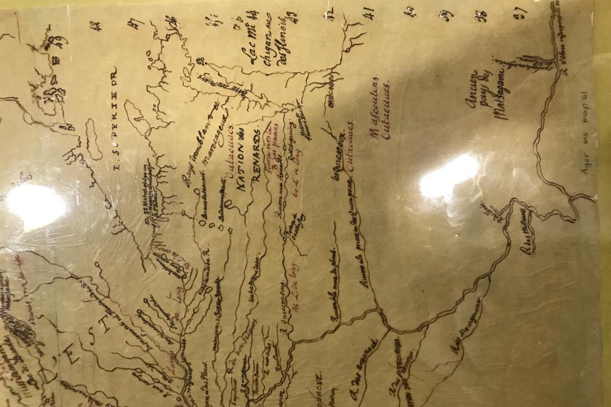
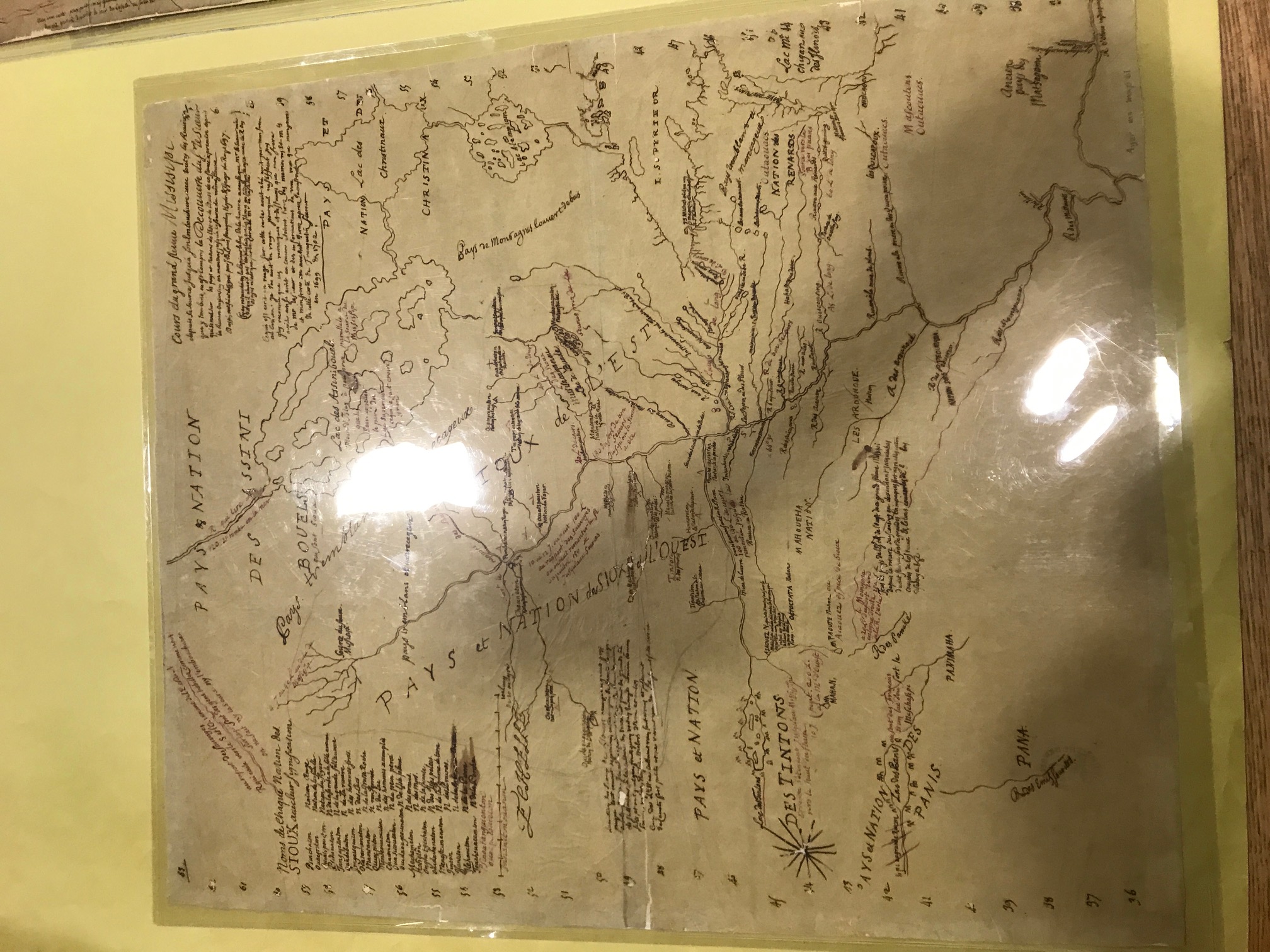
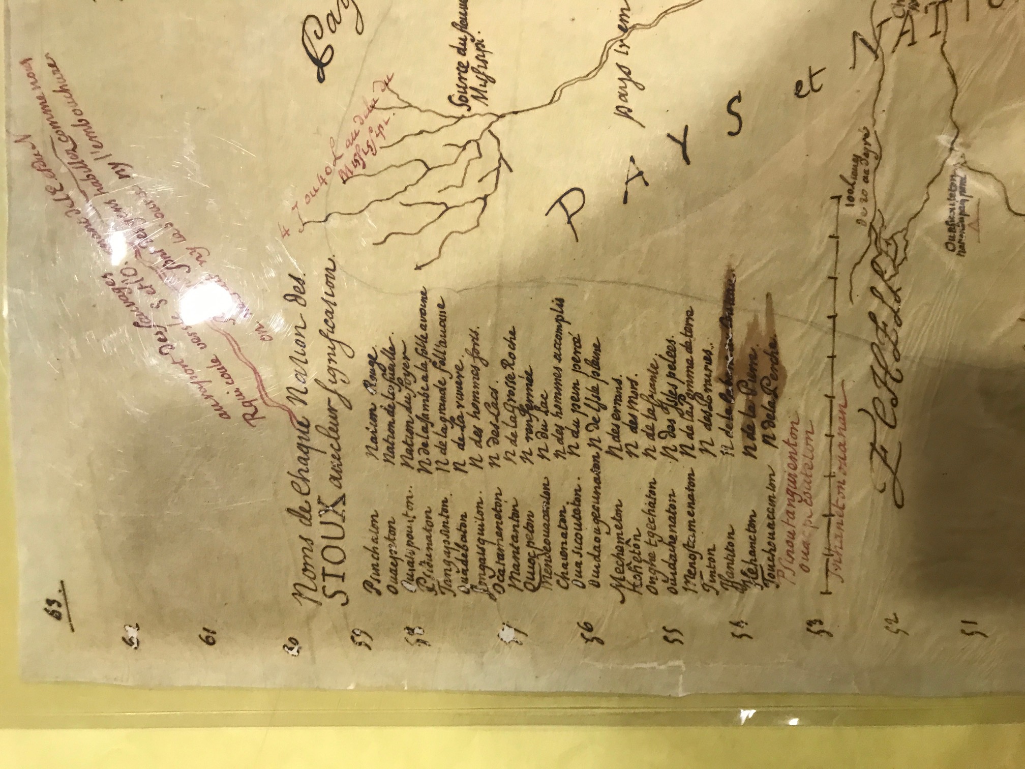
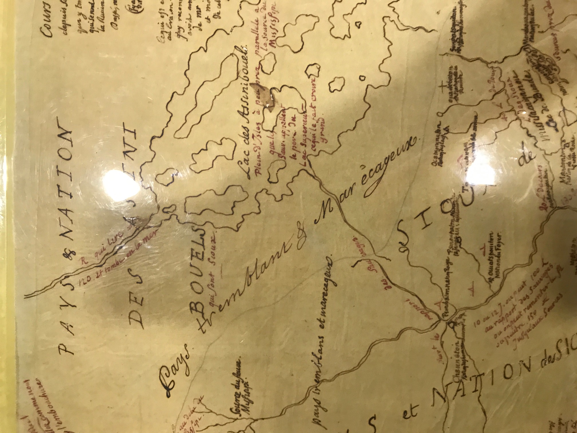
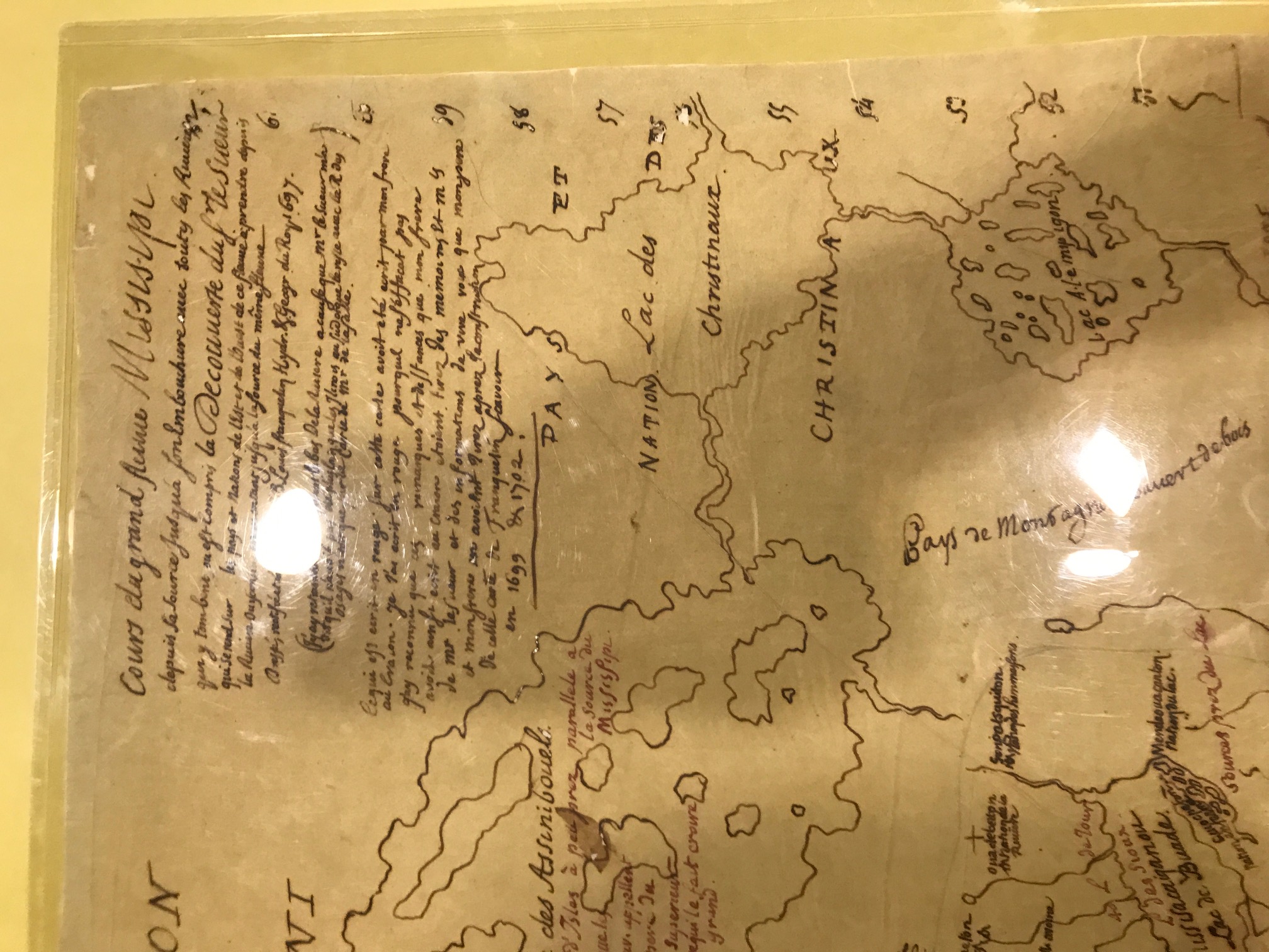
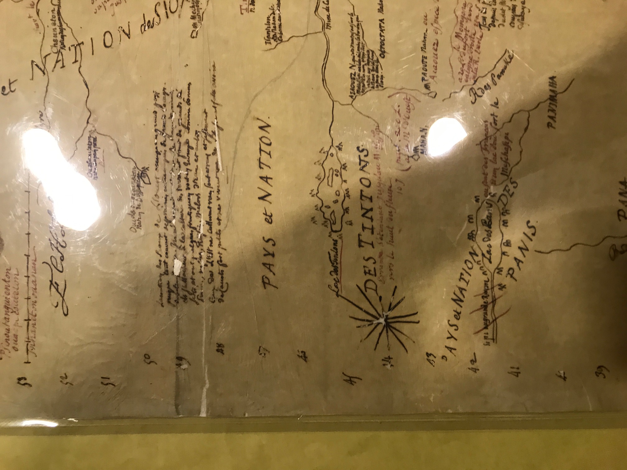
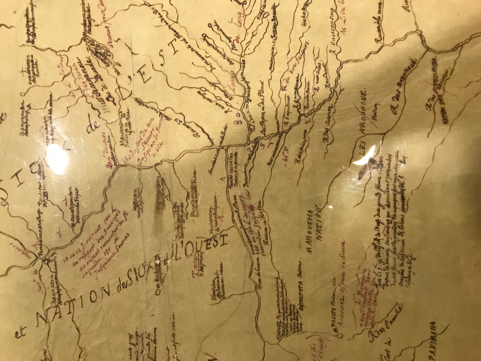
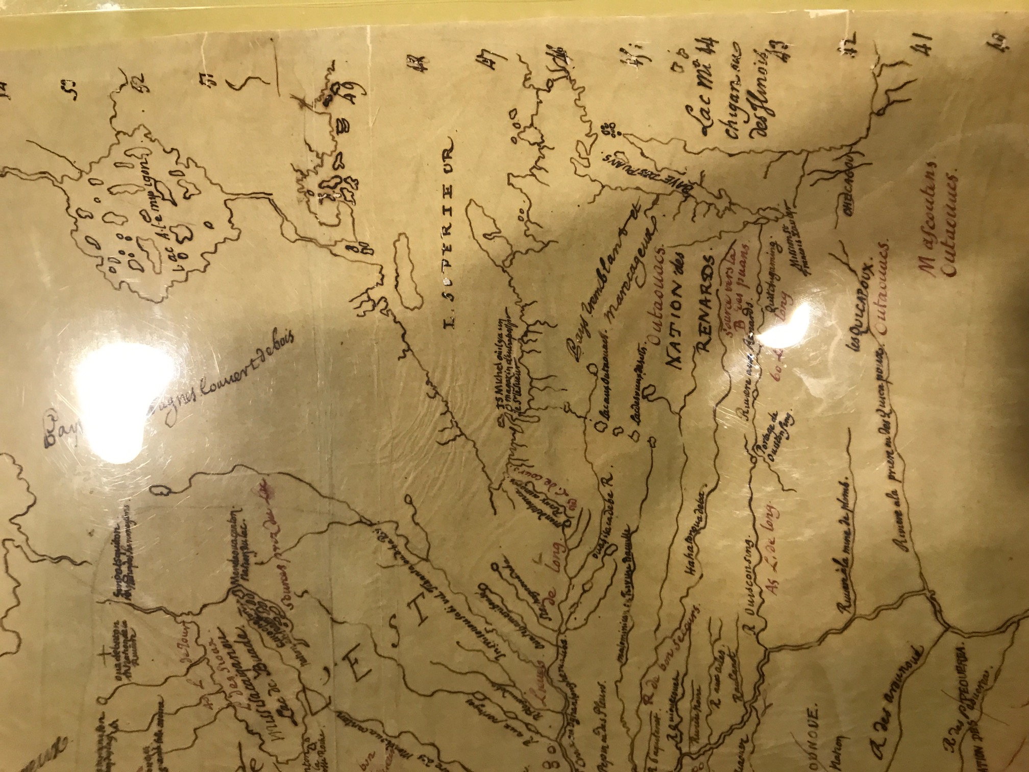
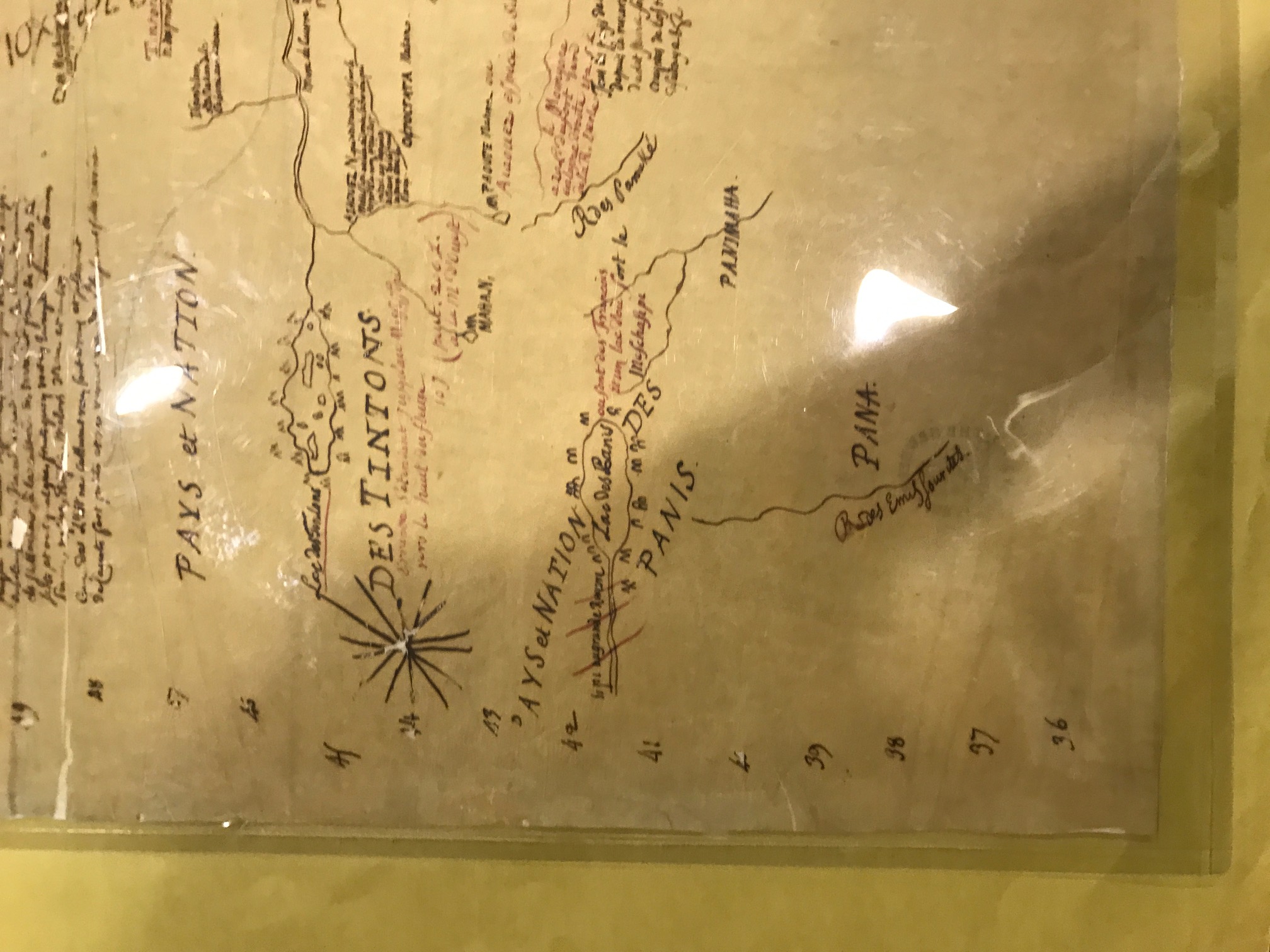
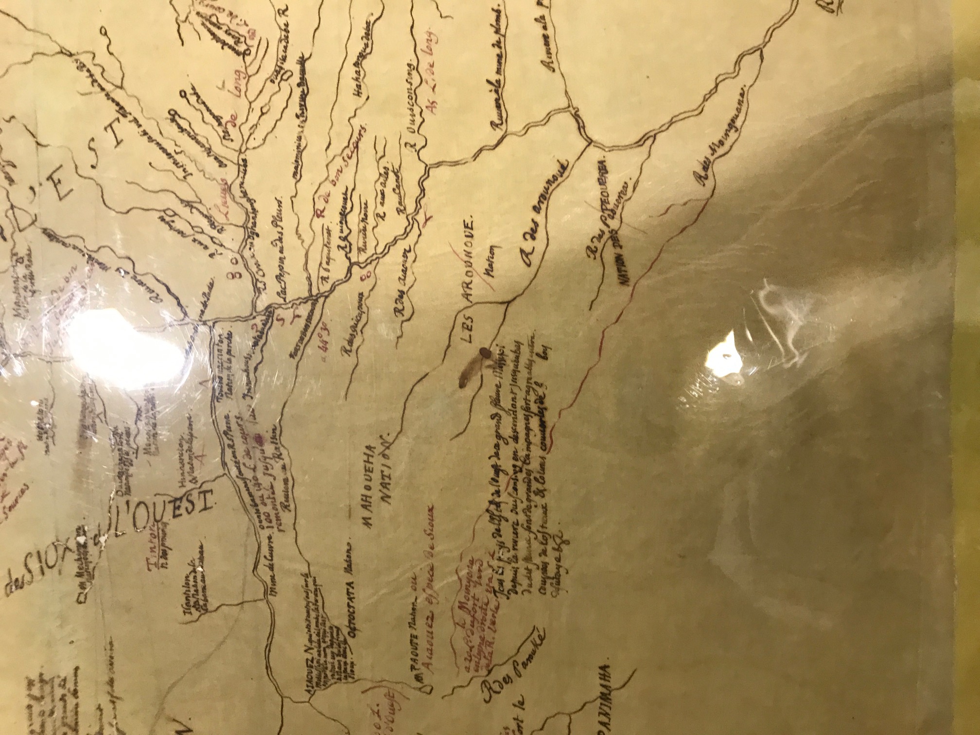
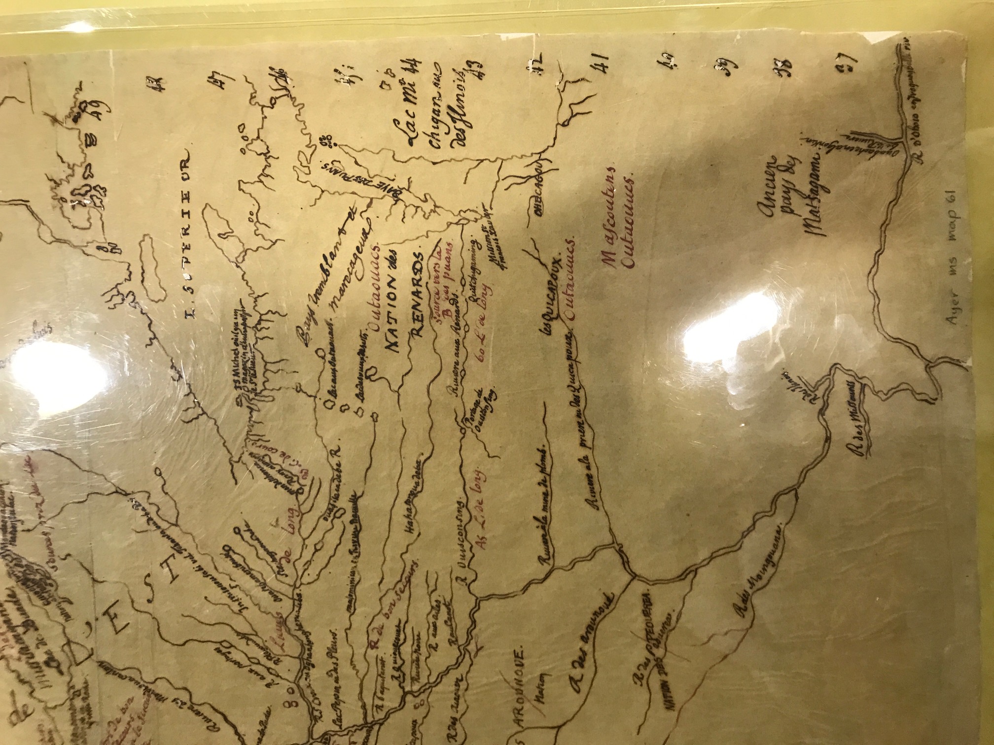
Shows upper Mississippi River Valley and tributaries; roughly bounded by the headwaters of the Mississippi, Lake of the Woods, Lake Superior, the mouth of the Ohio River, and the Minnesota River as far west as Big Stone Lake. Identifies numerous Indian regions and villages and includes a list of 23 Dakota tribal names with French glosses in upper left. Tracing made ca. 1850 by historian Pierre Margry from 1697 map by French royal geographer Jean Baptiste Louis Franquelin. Based on information supplied by fur trader Pierre-Charles Le Sueur, who explored the Mississippi River valley between 1683-1701. Includes transcribed annotations by Claude and Guillaume de L'Isle. Original (apparently lost) probably traced by Margry in the Service Hydrographique archives (Paris). Described and reproduced in Wedel, Mildred Mott. "Le Sueur and the Dakota Sioux" in Aspects of upper Great Lakes anthropology / ed. by Elden Johnson (St. Paul, Minn.: Minnesota Historical Society, 1974) p. 157-171. See also Delanglez, Jean. "Franquelin, mapmaker" in Mid-America n.s. v. 14 no. 1 (Jan. 1943) p. 29-74
Additional tribal affiliations, some in French. Mascouten, and other unknown names like "Matsigami," "Outaouues," or "Outaouaes" (Ottawas/Odawas?), "Quicapoux," (Kickapoo?), "Renards," (Fox?), "Puans," (Hochunk), Peoria, and Nakota and Lakota.


 Carte de la Louisiane, 1718, Detail of Lake Michigan, Chicago_o2.jpg")

